. They can be used as a way to enhance and add more meaning to the location of an entity. For example you may want to put the name of a particular place on the map, geofences let you do this. Geofences can also be used along with notifications for alerting when an entity enters or exits a particular area of the map.
In tracking it can give you a better idea of where your entities are since you can define the name of the geofences.
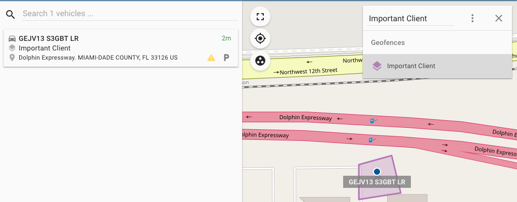
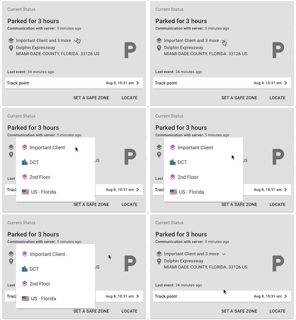
If the entity is inside multiple fences, the smallest fence is shown first and then you can expand the list clicking the dropdown arrow and the rest of the geofences (smallest to largest) will show.
Creating a Geofence
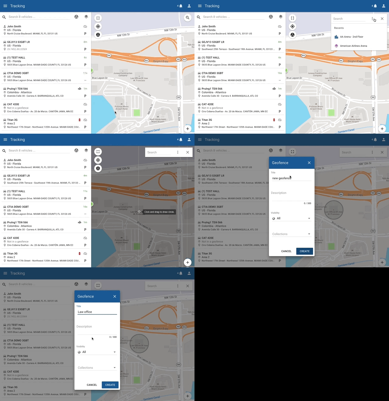
To create a geofence you can do it from anywhere the map is visible,
If you are viewing the map on a small screen, such as a phone or tablet, you’ll find a search icon on the map,  after clicking it you can click on the
  icon that displays a menu, from there you can either select
  to draw a circular region, or
 to draw a polygonal region.
Circular
Once you clicked on the Draw circle on the menu in the map, click anywhere on the map and drag outwards from the center.
Polygon
For polygon geofences you need to make multiple clicks on the map to draw the geofence’s perimeter. To finish drawing just click on the first point.
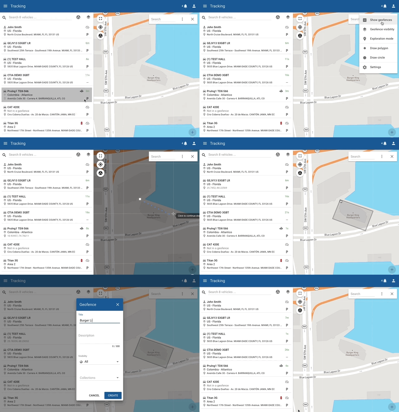

Note that the max amount of points a polygon can have is 300.
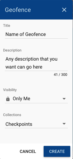
Once you’re done creating the geofence you’ll have a dialog that shows up where you’ll enter the name of the geofence, a description, choose who can see the geofence (public, people in your group, or private), and whether or not it belongs to a collection.
GEOFENCE COLLECTIONS
Collections are very useful when you want to work with notifications, by using a notification that works over a collection you’ll save yourself the trouble of having to update a notification whenever you create a new geofence.
Creating a collection
In order to create a collection you’ll need access to the Geofences module, you can get there from the main menu.

Once in the geofences module you’ll go to the tab that says Collection, and click on the  bottom right of the list.
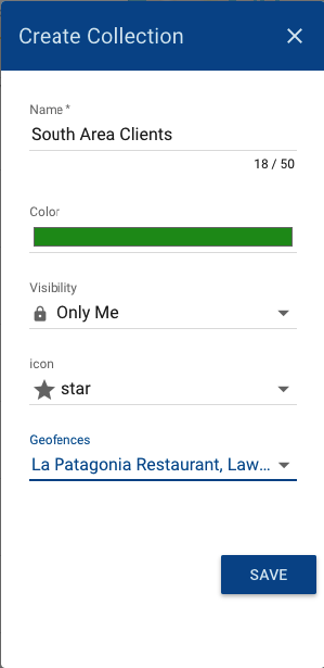
From here you can give the collection a name, color, icon, and select the geofences that belong to that collection.